
Updated 4:00 p.m. July 24:
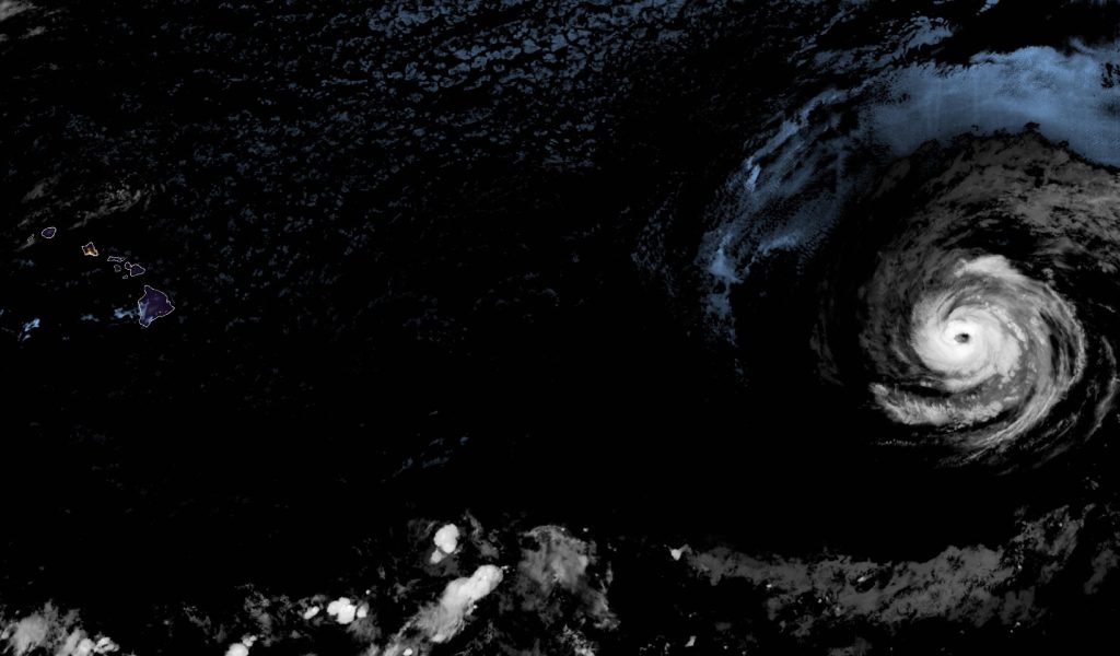
Hurricane Fausto Friday update: The first hurricane of 2026 to enter the Central Pacific strengthened overnight to Category 2, with maximum sustained winds of 105 mph as of the 11 a.m. Friday advisory from the National Weather Service.
The cyclone was located about 1,460 miles east of Hilo and moving west near 15 mph. Forecasters expect it to continue generally west for the next several days.
Fausto is believed to be at or near peak intensity. Gradual weakening is anticipated as it tracks over cooler water and encounters drier air and increasing wind shear.
According to the Kauaʻi Emergency Management Agency, the Weather Service has fairly high confidence Fausto will be a tropical storm when it nears Hawaiʻi. There are no coastal watches or warnings in effect for the state.
Even so, the risk of wind and rainfall impacts in Hawaiʻi is increasing, and it is still too soon to pinpoint where or how severe those effects might be. If the current forecast holds, parts of the islands could see strong winds, hazardous surf, and rain as early as Monday night.
“We’re keeping an eye on the system and will provide updates as we learn more about its track,” Mayor Kimo Alameda said. “The storm is also a good reminder to make sure that you and your family are prepared this hurricane season.”
Hurricane Fausto Friday update: What to do now
Hawaiʻi County urged residents to take steps now to reduce risk and stay safe:
- Plan where you will shelter at home or relocate to a safe place before a storm arrives.
- Trim vegetation that could blow down and damage your home.
- Clear debris so water can flow around drainage areas.
- Ensure food, water, and medications are stocked for all household members, including pets.
- Prepare for possible power outages.
- Sign up for Civil Defense emergency alerts online.
Civil Defense Administrator Talmadge Magno noted that a busier-than-normal cyclone season is forecast. He added that spring rains spurred heavy vegetation growth, raising wildfire risk as summer continues, and encouraged residents to prepare for both hurricanes and fire hazards.
Hurricane Fausto Friday update: Surf and wind footprint
Elevated surf is expected along east-facing shores late this weekend into early next week. The Weather Service cautioned that swells could produce life-threatening surf and rip currents. A national rip current risk depiction is available from the National Hurricane Center.
Hurricane-force winds extended up to 45 miles from Fausto’s center, with tropical-storm-force winds reaching up to 185 miles.
Hurricane Fausto Friday update: High surf advisory extended
A high surf advisory for south-facing shores statewide has been extended until 6 p.m. Saturday. Forecasters in Honolulu said the current south-southwest swell should ease tonight, but a reinforcing long-period pulse is expected to return surf to advisory levels by Saturday afternoon and possibly through the weekend.
The Hawaiʻi County Department of Water Supply also urged customers to get storm ready and shared preparation tips as Fausto moves closer to the region.
Officials said additional updates will be issued as Fausto continues on its westward track toward Hawaiʻi. For more on Fausto’s development, see Hurricane Fausto strengthens to Category 1, more gains likely.