
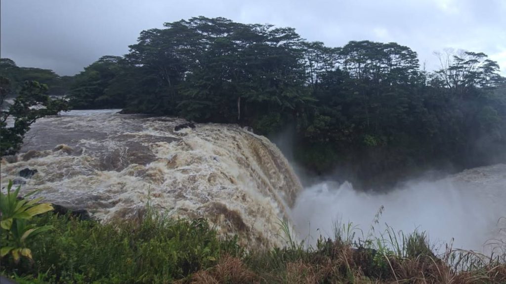
Big Island rainfall June 2026 surged across windward and upper slope areas, where most gauges logged well above their typical June averages, according to the National Weather Service. In contrast, several leeward locations, including stretches of the Kona and Kohala coasts and higher interior elevations, came in below normal.
Forecasters noted the sharpest leeward deficits at Kaloko-Honokōhau and Kona International Airport, which measured just 14% and 5% of their average June rainfall.
Big Island rainfall June 2026: 10 sites set June records
Ten gauges around Hawaiʻi Island reported their wettest June on record:
- Hakalau RAWS (since 2004)
- Honokaʻa Ua Net (since 1991, with missing data in 1996 and 1999)
- Kapāpala Ranch Ua Net (since 1999)
- Kapāpala RAWS (since 2012)
- Keaumo RAWS (since 2012)
- Kealakomo RAWS (since 2010)
- Nēnē Cabin RAWS (since 2015)
- Pali 2 RAWS (since 2003)
- Puʻu Mali RAWS (since 2015)
- Pāhala Ua Net (since 1991)
At Hilo International Airport, two daily rainfall records fell: 3 inches on June 1, topping 1.39 inches set in 2015, and 1.99 inches on June 10, surpassing 1.17 inches set in 2002. Hilo totaled 11.39 inches for the month, 156% of its June average of 7.3 inches.
The U.S. Geological Survey gauge at Saddle Road Quarry led the island and the state with 26.82 inches for June, 322% of its 8.34-inch average. It also captured the highest single-day total, 10 inches on June 2.
Other notable rainfall totals for June
- Silversword: 12.33 inches, average 0.9 inch, 1,370%
- Keaumo: 11.31 inches, average 1.27 inches, 891%
- Hakalau: 19.75 inches, average 2.8 inches, 705%
- Kapāpala: 10.68 inches, average 1.6 inches, 668%
- Kapāpala RWS: 9.6 inches, average 1.75 inches, 549%
- Pāhala: 10.95 inches, average 2.06 inches, 532%
- Honokaʻa: 19.55 inches, average 4.62 inches, 423%
- ʻAhumoa: 3.73 inches, average 1.04 inches, 359%
- Pōhakuloa Kīpuka ʻAlalā: 1.78 inches, average 0.55 inch, 324%
- Kawainui Stream: 25.42 inches, average 9.87 inches, 258%
- Pali 2: 6.79 inches, average 2.82 inches, 241%
- Puʻu Mali: 3.39 inches, average 1.45 inches, 234%
- ʻUpolu Airport: 6.23 inches, average 2.78 inches, 224%
- Pōhakuloa Keʻāmuku: 1.91 inches, average 0.92 inch, 208%
- Kealakomo: 4.95 inches, average 2.38 inches, 208%
- Lower Kahuku: 8.16 inches, average 4.05 inches, 201%
Other notable least rainfall totals for June
- Kāʻināliu: 3.6 inches, average 5.8 inches, 62%
- Kealakekua: 3.75 inches, average 6.05 inches, 62%
- Pūhe CS: 0.35 inch, average 0.57 inch, 61%
- Mauna Loa: 0.24 inch, average 0.43 inch, 56%
- Puʻu Anahulu: 0.79 inch, average 1.97 inches, 40%
By the end of June, year-to-date rainfall on the island was still largely near to above normal. A few leeward South Kohala spots remained below average.
The highest year-to-date total was at the USGS gauge on Honoliʻi Stream, which reached 154.86 inches, or 140% of its typical 110.78 inches by this point in the year.
Other notable year-to-date rainfall totals for June
- Mauna Loa: 19.74 inches, average 5.98 inches, 330%
- Pāhala: 76.44 inches, average 26.9 inches, 284%
- Kapāpala: 70.9 inches, average 25.8 inches, 275%
- Kapāpala RWS: 69.38 inches, average 26.32 inches, 264%
- Keaumo: 63.01 inches, average 25.34 inches, 249%
- Silversword: 42.59 inches, average 17.93 inches, 238%
- ʻAhumoa: 24.01 inches, average 11.93 inches, 201%
As of July 7, the U.S. Drought Monitor showed 22.69% of Hawaiʻi Island in abnormally dry conditions. Three months earlier, on April 7, 42.65% was abnormally dry and 9.6% was in moderate drought.
Conditions are far better than a year ago on July 8, 2025, when nearly 90% of the island ranged from abnormally dry to extreme drought, including almost 3% in extreme drought, 57% in moderate drought and 20.55% in severe drought.
Statewide rainfall summary for June
June opened with wetter-than-normal trade wind weather as a weak surface trough from the southeast boosted moisture June 1 and 2. Moderate trades concentrated heavier showers over windward and mauka zones, with a southeast component enhancing rainfall over Kaʻū and Puna on the Big Island and the south slopes of Haleakalā on Maui.
Totals generally ranged from 3 to 5 inches, with isolated 7 to 10 inches along the Hāmākua and Kaʻū coasts. Flooding closed a portion of Highway 11 between Kāwā and Honuʻapo in Kaʻū.
A typical early summer trade pattern returned June 3 to 10 with moderate to locally breezy easterly winds and scattered windward and mauka showers. Trades then eased through June 16, allowing local land and sea breezes.
Rainfall was limited overall, though a brief uptick in trades June 14 to 15 increased windward showers.
Light easterlies persisted June 17 to 18 as another weak trough raised low-level moisture, briefly expanding showers across windward sections of the Big Island, Maui and Oʻahu. Minor flooding occurred along Kūhiō Highway near Hāʻena on Kauaʻi.
Drier, more stable conditions returned through June 22 on light to moderate east-southeast winds. While rainfall was limited, light winds and dew points in the lower 70s created warm, humid conditions June 19 to 20 before slightly drier east-northeast flow brought some relief.
Moderate to breezy trades resumed for the final week. A passing surface trough and weak upper-level instability increased windward and mauka showers through June 25, followed by breezy trades with typical scattered trade showers to close the month.