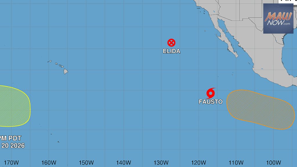

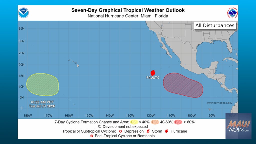
Hurricane Fausto intensified over the last day, with the National Hurricane Center reporting it as a Category 1 system with maximum sustained winds of 75 mph. Hurricane Fausto could strengthen further later today and into Wednesday, forecasters said.
As of about 8 a.m. Tuesday, Fausto was positioned roughly 735 miles southwest of the southern tip of Baja California and moving northwest near 12 mph. The National Hurricane Center expects a turn toward the west-northwest along with a quicker forward speed tonight and Wednesday.
Hurricane-force winds extend up to 25 miles from the center. Tropical-storm-force winds reach outward as far as 160 miles.
In the broader Central Pacific, forecasters are also monitoring a trough of low pressure southwest of Hawaiʻi that is generating disorganized showers and thunderstorms. Conditions appear favorable for gradual development as this area moves generally west in the coming days, according to forecasters.
Hurricane Fausto forecast and wind field
Officials said additional strengthening is likely through midweek, while the storm maintains its northwest to west-northwest track. There are no watches or warnings for Hawaiʻi, but The Trade Wind will continue to monitor Hurricane Fausto for any changes relevant to the islands.
While impacts remain unlikely in the near term, residents are encouraged to stay informed through official forecasts and local updates, including past coverage such as the Tropical Storm Amanda becomes first of 2026 Eastern Pacific report. For broader regional information and preparedness guidance, additional resources are available from National Weather Service offices that cover the Central Pacific.